Geography
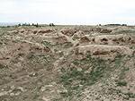
Uzbekistan has an area of 447,400 square kilometres (172,700 sq mi). It is the 56th largest country in the world by area and the 42nd by population. Among the CIS countries, it is the 5th largest by area and the 3rd largest by population. Uzbekistan lies between latitudes 37° and 46° N, and longitudes 56° and 74° E. It stretches 1,425 kilometres (885 mi) from west to east and 930 kilometres (580 mi) from north to south. Bordering Kazakhstan and the Aral Sea to the north and northwest, Turkmenistan to the southwest, Tajikistan to the southeast, and Kyrgyzstan to the northeast, Uzbekistan is one of the largest Central Asian states and the only Central Asian state to border all the other four. Uzbekistan also shares a short border (less than 150 km or 93 mi) with Afghanistan to the south. Uzbekistan is a dry, landlocked country. It is one of two doubly landlocked countries in the world - that is, a country completely surrounded by landlocked countries - the other being Liechtenstein. In addition, due to its location within a series of endorheic basins, none of its rivers lead to the sea. Less than 10% of its territory is intensively cultivated irrigated land in river valleys and oases. The rest is vast desert (Kyzyl Kum) and mountains. The highest point in Uzbekistan is the Khazret Sultan, at 4,643 metres (15,233 ft) above sea level, in the southern part of the Gissar Range in Surkhandarya Province, on the border with Tajikistan, just northwest of Dushanbe (formerly called Peak of the 22nd Congress of the Communist Party).
